Sunday, June 2, 1996
From Inverness to Loch Lochy
59.6 miles
Culloden Battlefield
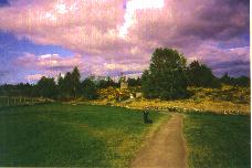 |
When I woke up at 7.00 in the morning I felt great, because I really slept very well. The only problem was that my knees
were aching. But as the TV weather forecast had been good for this day so quickly dropped the idea of staying in
Inverness for one more day. After a big breakfast I left the B&B at 9 o' clock and started on my way to the Culloden
battlefield. When I got there the sun was shining and I was glad that it was still early because that place probably is
filled with tourists on nice sunny sundays. I stayed at Culloden for about 30 minutes trying to imagine how this place
must have looked with the two armies facing each other. But I don't think that any person today really can imagine how
it had been on that April day in 1746.
Clava Cairns
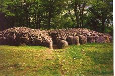 |
When I left Culloden battlefield I saw a road sign to some prehistoric site. After following that sign down a couple of
B or even C roads I came to Clava Cairns, an ancient burial site with three round stone tombs uncovered. I don't know
exactly which time they date from, but it was an interesting place to visit with these graves and the circles of
standing stones around them.
I then headed on in a southwestern direction and rode up Strathnairn and Stratherrick. This ride was especially
beautiful, because there were nearly no cars on the road, the sun shine was shining and the landscape was magnificent.
The only thing I didn't like was the head wind which was pretty strong all day long.
Loch Mhor
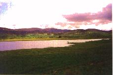 |
After passing some nice Lochs the valley became narrower the green farming fields gave way to dark forests.
Unfortunately the road began to climb as I came towards the end of the valley. But I had to go on, because riding on to
Fort Augustus was the only way I go could without turning back. Considering the pain in my knees and the head winds I
really thought about turning round, but that would have meant to ride back for about 25 miles and that seemed even worse
to me.
So I started fighting myself and the road and went on climbing the road up to a pass I could see in the distance.
But when I reached that place I saw that it was only the beginning of an even steeper climb about 2 miles away. And what
was worse, the road leading to that new climb was rolling up and down, so that every time I was glad I managed half a
mile uphill I was forced to go downhill for another 500 yards and then climb it all up again. That wouldn't have been so
bad, but when you can see the way you have to go for the next 3 miles it's really putting you down.
I'm on top!
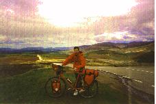 |
It was about 4.00 pm when I finally reached the highest point of that road, and when I was up there and looked around
all the pain and anger was forgotten: Looking back to the north I saw in the distance the hills behind which lay
Inverness. On the left hand side was a range of mountains and behind them you could see the Great Glen. I don't know the
names of the mountains to the east and the south but the sight was breathtaking. Up on the pass there was board
explaining what the names of the mountains and valleys were and that the road I had been coming up was called
The old military road
. I rested there for about half an hour and then went on towards Fort Augustus. The road I had to cycle down was very
steep and I really raced down with up to 35 mph (that doesn't sound too much, but always keep in mind that I was
carrying about 30kg, then you can imagine how long it would have taken to come to a stop if I had to).
Fort Augustus
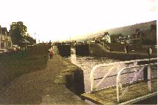 |
In Fort Augustus I spent about 1.5 hours at the locks, watching the boats and talking with people. Three of these were
Americans who were on a bicycle tour as well, but they only had light baggage as they stayed every night in hotels and
B&B's and so didn't need a tent and cooking stuff. We talked about bicycles (I know that Diamond Back normally
doesn't make hybrids), touring and stuff like that, but what they were especially interested in were my panniers,
because the ones they had got weren't waterproof and they never had seen panniers which are so easy to handle like the
ones from Ortlieb.
Loch Lochy
 |
Loch Lochy
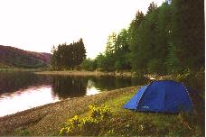 |
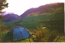
When I left Fort Augustus I first wanted to go as far as Invergarry and stay there at the camping site, but when I got
there I suddenly wanted to be alone without other people around me and so I rode on until I came to the northern end of
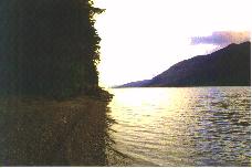
Loch Lochy. In the meantime it was about 8.00 pm. Looking down from the road to the lake I saw a small strip of sand at
the shores of the lake and that place looked so wonderful that I left the road and carried my bike down to the water.
The place was really beautiful: Crystal clear cold water, the mountains all around with the sun already sinking behind
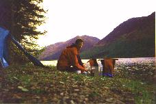
them, and nobody else around. It was exactly the place I had been looking for. I put up the tent, made dinner and then
checked and oiled the bicycle. After that I lay down in the tent looking out over the water and enjoying this peaceful
evening after that hard day.
Loch Lochy
 |
Loch Lochy
 |


