- Preparations
- The Map
- Germany to Balloch
- Balloch to somewhere behind Lochearnhead
- Somewhere behind Lochearnhead to Oban
- Oban to Glenfinnan
- Glenfinnan to the Sleat Mountains on Skye
- Sleat Mountains on Skye to Portree
- Portree to Shiel Bridge
- Shiel Bridge to Inverness
- Inverness to Loch Lochy
- Loch Lochy to Kingussie
- Kingussie to Elgin
- Elgin to Fraserburgh
- Fraserburgh to Aberdeen
- Aberdeen to Aboyne
- Aboyne to Bridge of Cally
- Bridge of Cally to St. Andrews
- St. Andrews to Edinburgh
- Edinburgh to Galashiels
- Galashiels to Gretna
- Gretna to Parton
- Parton to Ayr
- Ayr to Johnston
- Johnston to Germany
- The End
Sunday, May 26, 1996
From Balloch to somewhere behind Lochearnhead
51.8 miles
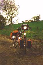
When I woke up in the morning at 7.30am it was cloudy and fresh, but despite the clouds there were patches of blue in the sky. I went for another short walk, waiting for the shops to open and then went shopping. Till I left the camping site it was 10.30am but regarding that I first had to make breakfast and then had to pack up my tent and all the rest that's not to bad anyway.
 |
Considering where to go I had two alternatives: Cycle the road on the west side of Loch Lomond which surely would be nice or head northeast in the direction of the Trossachs. But as it seemed to be a nice sunday I was afraid that the traffic on the Loch Lomond route would be more than I would like and so I headed for Loch Katrine. I left Balloch on the A811 , passed through Drymen and then changed to the A81 and after about an hour I arrived in Aberfoyle.
I had a short break there and talked to a guy on a bicycle who came from the direction I was heading to. He told me that there were two ways to get to Loch Katrine. One was a small way (he didn't call it a road) that goes around Loch Ard and Loch Chon to Loch Katrine, the other was the normal road over Duke's Pass down to Loch Katrine. I decided to take the second alternative, a decision which I regretted only about 15 minutes later. First I had to walk my bike up the Duke's Pass (I'm not punishing myself with trying to climb every hill on the bicycle) and then it started to rain.
 |
For sure, rain and hills are nothing uncommon in the Scottish Highlands, but it's hard when you just started your tour.
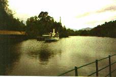
Well, the good thing was that when I arrived at Loch Katrine at about 1.00pm the weather had gotten a little better and I went for a lunch break in the cafe that's located near that steamship quay (just as I'm writing these words I wonder if it's a real steamboat). I left my bike with the two guys who were renting mountain bikes to the tourists and went up to the cafe for a sandwich and a cappucino.
 |
When I left Loch Katrine I first thought of driving to Callander to visit the Rob Roy museum but when I saw all the tourist attractions they make out of Rob like Rob Roy's Pub or Visit Rob Roy's grave with Rob Roy Tours I decided not to join this and just stayed out of Callander and rode on north towards Lochearnhead. A couple of miles from Callander there was a small way for bicycles which ran along on the other side of Loch Lubnaig than the normal road. It was a really nice ride that afternoon and although it had rained when I left Loch Katrine the rest of the day was dry and not too cold.
 |
I joined the A84 again in Strathyre where I stopped at a coffee room for a tea and sandwich. After that I cycled till about 6.00pm, then left the road about 2 miles behind Lochearnhead and stopped for the night in a small forest that was about 100 yards from the road. It was quite early for stopping but I was really tired after that day and wanted to sleep early. After cooking dinner I slept at about 8.00pm.